
Finding your way around
Getting around our campus is easy and accessible, with excellent transport links to student neighbourhoods and the city.
Getting your bearings
You’ll find most of the places you need are on campus or within walking distance.
- Many of the University buildings are located on Oxford Road and you'll spend a lot of time along here, either going to lectures, finding a study space or meeting friends in one of the many cafes on campus.
- Some of the key buildings you may visit include the library, University Place, and of course, The Students' Union.
- A free bus service connects you to other key areas and services you might need to access across campus.

Finding key buildings across campus
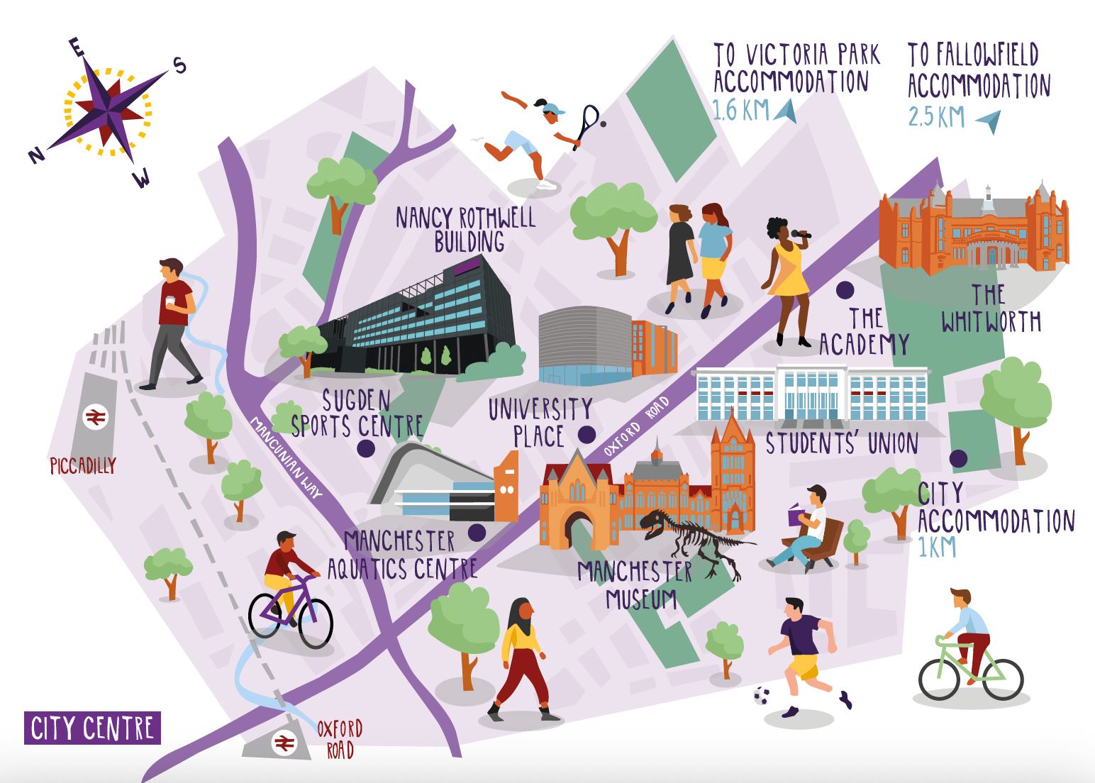
An illustrated map of The University of Manchester campus on Oxford Road, Manchester.
From left to right (north-east to south-west) this features illustrations of the buildings that represent:
- Piccadilly Train Station
- Sugden Sports Centre
- Manchester Aquatics Centre
- Nancy Rothwell Building
- University Place
- Manchester Museum
- The Students’ Union
- The Academy
- The Whitworth
It also shows the proximity to campus of the following locations:
- City accommodation (1KM from campus)
- Victoria Park accommodation (1.6KM from campus)
- Fallowfield accommodation (2.5KM from campus)
The map also illustrates students playing tennis, singing, playing football, cycling, sitting around campus and carrying coffee.
Take a tour
Find your way around the campus before visiting, and watch this campus tour from recent graduate Tim. Highlights of the tour include:
- the University arch, one of the most 'Instagrammable' places on campus;
- the picturesque Old Quadrangle, right next to many of the key student buildings;
- Brunswick Park right in the centre of campus, one of the best areas to relax outside or head through to one of the student-favourite cafes, Benugo.

Accessible campus
We want to make campus as accessible as possible.
You can explore an accessibility map of the University on the AccessAble website, which includes access guides for each building.


.jpg)